(L-R) Emcee: Atty. Roderick R.C. Salazar III, Mr. Jose Bayani Baylon, Hon. Luisa Rust (Senior Trade and Investment Commissioner of Austrade), Mr. Craig Annison (Geophysicist, Xcalibur Smart Mapping) [Photo by Job Paul Bulos of Philippine Mining Club]
---
The Philippine Mining Club Luncheon held on September 20 2024, featured a panel of high-profile speakers, each presenting their expertise and insights on the future of the mining industry. The event, co-hosted by Nickel Asia Corporation, Xcalibur Smart Mapping, and the Australian Embassy in the Philippines, brought together key players to discuss the latest trends, innovations, and challenges in mining and resource exploration.
One of the guest speakers was Mr. Jose Bayani Baylon. He is Nickel Asia Corporation’s Chief Sustainability Officer and Senior Vice President for Sustainability, Risk, Corporate Affairs, and Communications. Mr. Baylon is known for his interesting discussions and witty remarks as he debunks common misinformation about mining. As a leading advocate for sustainable mining practices, Baylon’s lecture focused on the industry’s evolving role in balancing economic growth with environmental stewardship.
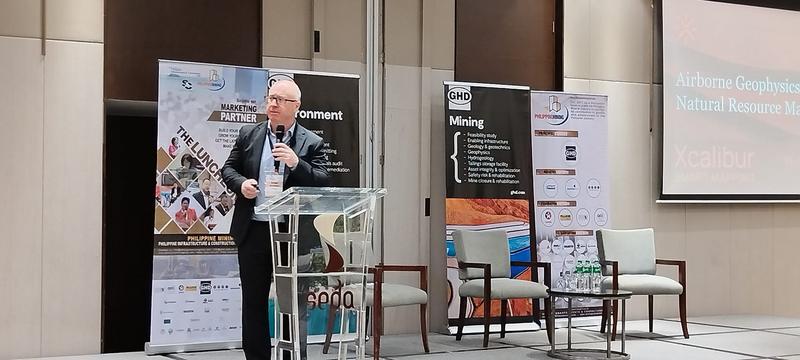
Mr. Craig Annison, a highly experienced geophysicist from Xcalibur Smart Mapping, followed with a presentation on "Airborne Geophysical Mapping for Exploration, Development, and Management of Natural Resources." Mr. Annison shared his technical expertise in deploying cutting-edge geophysical technologies to enhance resource discovery and management. He discussed how these innovations are reshaping the landscape of mineral exploration.
Representing the diplomatic sector, Honorable Luisa Rust, the new Senior Trade and Investment Commissioner of the Australian Trade and Investment Commission (Austrade) at the Australian Embassy in the Philippines, took the stage to discuss the critical role of trade and investment in fostering closer ties between Australia and the Philippines, particularly in the mining sector. Hon. Rust highlighted key opportunities for collaboration and investment that could drive economic growth in both nations.
The Luncheon was moderated by Atty. Roderick R.C. Salazar III, Senior Partner at Fortun Narvasa & Salazar, who served as the emcee. Atty. Salazar, known for his expertise in corporate law and mining policy, provided insightful commentary throughout the event, ensuring the discussions remained engaging and informative.
Global Leader in Airborne Geophysics
During the Luncheon, Xcalibur Smart Mapping discussed how mining companies may benefit from their advanced technologies.
With over 100 years of experience and more than 50 million linear kilometers of geophysical data collected across six continents, Xcalibur Smart Mapping is the largest airborne geophysical group in the world. Operating out of 16 offices, including key locations such as Perth, Madrid, Houston, and Toronto, Xcalibur provides services for the exploration and production of minerals, oil and gas, groundwater, geothermal energy, natural hydrogen, and other natural resources. The company’s advanced technologies also support environmental and engineering studies.
“Our core values of safety, sustainability, technological innovation, and operational excellence are central to our operations. This ensures that we execute projects efficiently and responsibly.”

Mr. Craig Annison, geophysicist from Xcalibur Smart Mapping
Key Projects in Asia and Oceania
Xcalibur Smart Mapping is currently involved in major natural resource mapping projects across Asia and Oceania, with an impressive portfolio. Notable projects include extensive surveys in Australia, Papua New Guinea, Mongolia, Japan, India, and Saudi Arabia, utilizing state-of-the-art airborne geophysical technologies such as magnetic, radiometric, gravity gradiometry, and electromagnetic mapping.
Between 2007 and 2009, Xcalibur completed a 290,000-line-kilometer airborne geophysical survey in Papua New Guinea. The data from this project significantly increased foreign investment in the country’s mineral sector, because it provided critical insights into the nation’s mineral resources and geological potential.
Technological Innovations in Natural Resource Mapping
Xcalibur's expertise spans a wide range of cutting-edge airborne geophysical technologies, including magnetics, radiometrics, electromagnetics, and gravity gradiometry. These technologies have been applied to a variety of exploration areas, such as geothermal energy, mineral deposits, and aquifers. In addition, the company’s use of innovative proprietary systems, such as TEMPEST AEM and FALCON AGG, provided high-resolution mapping of mineral-rich areas and other natural resources, leading to more accurate exploration results.
The presentation also showcased the success of their XMAG and HELITEM systems, which have been used to identify key mineral deposits, including critical minerals such as palladium, platinum, copper, cobalt and nickel, rare earth elements, and precious metals such as gold.
Xcalibur Foundation’s Social Impact
Beyond its technical prowess, Xcalibur is also making strides in its corporate social responsibility efforts. Through the Xcalibur Foundation, the company has launched several social development projects aimed at supporting education, training, and cultural development in vulnerable communities. Initiatives include football and basketball academies in Uganda and DR Congo, as well as women’s empowerment and employment programs in Spain.
“Xcalibur is deeply committed to shaping a better future through our social initiatives, using education and sport as tools to uplift children, young people, and women in vulnerable situations,” according to Craig Annison’s presentation.
Driving Exploration and Investment
As the demand for natural resources continues to rise globally, Xcalibur Smart Mapping’s data-driven approach helps de-risk investments and focuses exploration in areas with high potential. By providing essential sub-surface data, the company ensures that natural resources are responsibly managed and efficiently discovered.
“Our work is critical for making informed decisions in natural resource exploration. We are proud to play a role in advancing global resource development while maintaining our commitment to sustainability.”


