
February 17, 2025

Written by: ROGER KOO, FLUKE NETWORKS PRODUCT MANAGER, FLUKE SOUTH EAST ASIA PTE LTD AND MARK CONNELL, FLUKE CCTT FACILITAOR SOUTH PACIFIC, MEASUREMENT COMMUNICATION SOLUTIONS

In the vast and rugged mining landscape, where operations stretch across thousands of kilometres in some of the most remote locations on Earth, connectivity is critical. From ensuring the safety of workers to maintaining seamless production, network reliability is the backbone of mining operations. However, with extensive fiber, copper and coaxial cable networks spanning both underground tunnels and above-ground facilities, identifying and resolving faults efficiently is akin to looking for a needle in a haystack.

Fluke Networks, the trusted leader in Ethernet network testing and certification, is at the forefront of ensuring that mining infrastructure and networks remain connected and operational. By providing state-of-the-art network test tools, training and pre-emptive maintenance solutions, Fluke helps mining companies minimise downtime, enhance safety and security and improve operational efficiency. The Fluke Networks suite of solutions, an essential part of every technician’s tool bag, is indispensable in identifying and resolving network connectivity faults quickly, ensuring mining operations and networks stay online.

Mining Connectivity: The Lifeline of Remote Operations

For operating mines, network reliability is non-negotiable. These mines are not just workplaces; they are self-sustaining communities where employees live, work and communicate online with their families. Whether it is operating autonomous mining trucks and trains, controlling production equipment, or maintaining security surveillance systems, mining operations depend on robust network infrastructure.

Fluke’s cable and network testing solutions play a crucial role in:

  • Fault Detection and Prevention – Identifying and resolving fiber, copper and coax faults before they cause major disruptions.
  • Uptime Optimization – Keeping mines operational by ensuring stable network connectivity.
  • Security and Safety – Supporting surveillance and monitoring systems to protect personnel and assets.
  • Efficiency and Compliance – Helping mining operations meet local standards for network installations and maintenance.

The Challenge: Network Faults in Harsh Mining Environments

Mining environments present extreme conditions that put network infrastructure to the test. Fiber optic cables, which serve as the backbone for data transmission in these operations, can be easily damaged by vibrations, heavy machinery, or accidental excavation. Given the sheer scale of mining sites, some spanning over 700 kilometres, it would be nearly impossible to locate faults manually.

A single undetected network failure can impact a mine in multiple ways:

  • Autonomous Equipment Failure: Disruptions in fiber optic networks can cause automated mining trucks and trains to malfunction, leading to costly delays.
  • Security System Downtime: Security cameras and monitoring systems rely on uninterrupted connectivity. A fault in a cable could lead to blind spots, leaving valuable assets and personnel at risk.
  • Communication Breakdowns: Workers depend on network reliability to stay in contact with remote control centres, often located thousands of kilometres away.
  • Operational Delays and Financial Losses: Downtime in mining operations translates to significant financial losses, not only in production delays but also in costly demurrage charges for delayed shipments at ports.

Fluke’s Solution: Reliable Network Testing and Training

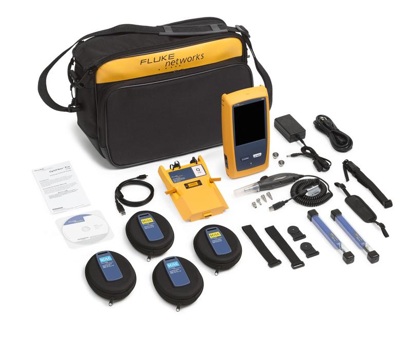
Fluke’s comprehensive suite of cabling and network testing tools, example, the OptiFiber Pro, empowers mining operations to detect faults quickly, reducing downtime and increasing efficiency. Traditionally, identifying a fiber optic break could take days, but with Fluke’s precision tools, it now takes just seconds.

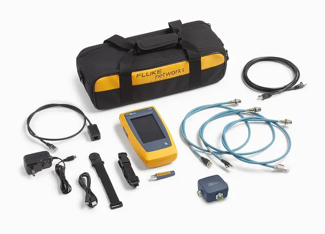
The LinkIQ™ Cable+Wi-Fi+Network Tester is another tool in the bag that helps to verify cable performance up to 10 Gb/s using frequency-based measurements and solve network connectivity problems. It performs ping tests to verify connectivity and nearest switch diagnostics to identify key network issues and validate switch configuration. Additionally, the Industrial Ethernet (IE) models allow identification of cabling issues on RJ45, M12X, M12D, and M8D terminated cables supporting EtherNet/IP, PROFINET, EtherCAT and other IE protocols. Test results are downloadable and managed via the LinkWare™ PC software.

Fluke’s solutions support mining operations by:

  • Providing Basic and Advanced Fiber Optic Testing Tools – These instruments allow engineers to maintain proper fiber optics hygiene, locate faults instantly, reducing network downtime.
  • Providing Visibility into Cable and Network – Answers the question if it is the cabling link or network configuration that is preventing network connectivity?
  • Supporting Multi-Network Connectivity – Mining operations rely on multiple interconnected networks, including IT, production, and security networks. Fluke’s solutions ensure seamless operation across all systems.
  • Supporting Training and Certification for Network Technicians – Fluke offers accredited training programmes, such as the Certified Cabling Test Technician (CCTT) programme, ensuring mining staff are fully equipped to maintain and troubleshoot networks.
Fluke OptiFiber® Pro OTDR is designed for both enterprise and OSP environment. Automated setup senses fiber characteristics and sets measurement parameters to discover and locate fiber faults at the mine site.


Case Study: Rapid Fault Detection Saves Time and Money

A major Australian mining operation recently encountered persistent network failures in its security surveillance system. A key security camera, positioned in a sensitive area, was intermittently cutting out. Over a week of troubleshooting, engineers first replaced the camera, then the network switch, yet the issue persisted.

Upon using a Fluke cable analyser, the true cause was identified within eight seconds, simply a bad cable connection. By the time the true fault had been identified, the company had already spent over $10,000 on unnecessary hardware replacements. If they had known what to look for and used Fluke’s cable analyser tool first, the issue would have been swiftly resolved and precious time and money saved. Beyond monetary losses, the risk of an unmonitored security breach for an entire week underscored the critical importance of network fault detection and having the right training to troubleshoot issues through the process of elimination in the correct order.

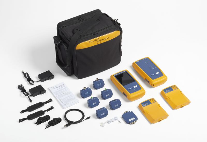
Fluke Industrial Ethernet CableAnalyzerTM Kit is suitable for harsh industrial environments, for validation and advanced troubleshooting of copper, fiber and coax cabling infrastructure at the mine site.


Beyond Mining: Fluke’s Role in Port and Logistics Connectivity

Mining operations do not end at excavation. The transportation of mined materials to ports and cargo ships depends on seamless network infrastructure. Port conveyors, cranes and automated loading systems are heavily reliant on fiber optic and electrical networks. A single break in connectivity can delay ship departures, leading to millions of dollars in lost revenue.

Fluke’s fiber optic testing solutions are just as essential in port environments as they are in the mines. By ensuring reliable connectivity, mining companies can avoid costly delays and streamline their supply chain operations.

Training: Empowering the Workforce for the Future

Fluke doesn’t just supply cutting-edge tools. It also invests in training the workforce to handle network infrastructure effectively, with a range of online video trainings and webinars available on its website and its Certified Cabling Test Technician (CCTT) programme. This industry-recognised, hands-on, BICSI CEC-approved certification ensures that mining technicians:

  • Understand best practices for fiber optic maintenance.
  • Can quickly troubleshoot and fix network faults.
  • Stay up to date with the latest tools and requirements of testing standards (ISO, TIA).
  • Renew their certification every two years (mandatory) to keep skills sharp.

By keeping technicians well-trained, Fluke helps mining companies reduce human error, enhance operational safety and ensure network uptime.

The Future of Mining is Secure Connectivity

In an era where connectivity is the foundation of safe and secure mining operations, Fluke provides the tools and training necessary to keep mines running without interruption.

For the mining industry, every second of downtime matters. Investing in Fluke Networks Cable and Network Test solutions goes beyond maintaining operations. It ensures the safety and security of everyone on site.

Want to safeguard your mining network? Discover how Fluke’s tools and training can keep your operations connected, secure, safe and productive.

February 17, 2025

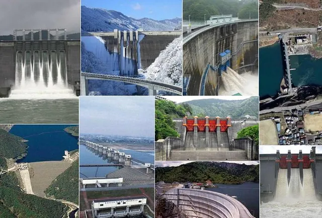
The Philippine government, through the Department of Public Works and Highways (DPWH), has strengthened its collaboration with Japan’s Ministry of Land, Infrastructure, Transport, and Tourism (MLIT) to enhance flood control and water resources management efforts in flood-prone areas across the country.

A pivotal moment in this partnership occurred during the 5th Seminar on Disaster Management Operations, Urban Flood Control and Dam Development held on February 13, 2025, at the Bayleaf Hotel in Intramuros, Manila.

DPWH Senior Undersecretary Emil K. Sadain together with MLIT Assistant Vice Minister Ishikawa Shin, Embassy of Japan Minister for Economic Affairs Nihei Daisuke, and Japan International Cooperation Agency (JICA) Philippines Office Senior Representative Yanagiuchi Masanari spearheaded the seminar aimed to push forward integrated flood control solutions and Integrated Water Resources Management (IWRM) through Japan’s cutting-edge technology and engineering expertise.

Organized by the DPWH Unified Project Management Office - Flood Control Management Cluster (UPMO-FCMC) headed by Project Director Ramon A. Arriola III, the forum sought to to enhance cooperation among key national agencies, focusing on vulnerable areas like Metro Manila, and strengthening disaster management capabilities.

Senior Undersecretary Sadain emphasized the importance of the seminar in fostering collaboration and enhancing technical knowledge and expertise fundamental to achieving resilient and sustainable disaster risk management operations especially in the National Capital Region, including areas like Marikina, Pasig, San Juan, Parañaque, and Taguig.

“Our longstanding partnership and collaboration with Japan remains instrumental and pivotal to the government’s efforts in strengthening our flood control and integrated water resources system management, which are key players in improving the urban planning in Metro Manila,” added Senior Undersecretary Sadain.

Currently, DPWH, together with the Metropolitan Development Authority (MMDA), is expediting the completion of the Metro Manila Flood Management Project (MMFMP) Phase 1, which aims to improve drainage systems and solid waste management practices, benefiting approximately two (2)-million beneficiaries in priority flood-prone areas in Metro Manila in 2026.

The forum also explored the status of Flood Risk Information in the Philippines, demonstrating the shared efforts of relevant agencies to develop comprehensive and informed disaster risk reduction planning despite prevalent challenges, primarily the worsening impact of climate change in the country.

In response to the devastation caused by recent typhoons, including Typhoons Carina and Kristine, which severely affected parts of Luzon, the DPWH, in cooperation with JICA, is fast-tracking updates to the master plans for key river basins. These include the Pasig-Marikina River Basin and the Cagayan River Basin.

Moderated by UPMO-FCMC Project Manager Jerry Fano, the forum featured key experts including Engineer Rosalita M. Barde from MMDA; Project Manager Michael T. Alpasan and Engineer Lydia C. Aguilar from UPMO-FCMC; Director Kondo Osamu of Japan’s Department of Water Resources & Disaster Prevention Research, Infrastructure Development Institute of Japan; Assistant Director Tsuda Morimasa of Japan Water Agency; Department of Science and Technology (DOST-PAGASA) Hydrologist Ailene R. Abelardo; and MLIT Director for International Coordination of River Engineering Maruyama Kazuki.

The event was also attended by DPWH Regional Director Khadaffy Tanggol of Cordillera Administrative Region; Director Randy R. Del Rosario of Stakeholders Relations Service; UPMO FCMC Project Managers and staff; and representatives from relevant national government agencies such as the Department of Science and Technology (DOST), Department of Environment and Natural Resources (DENR), Department of Energy (DOE), Department of Finance (DOF), Department of Human Settlements and Urban Development (DHSUD), Department of Interior and Local Government (DILG), Metropolitan Manila Development Authority (MMDA), National Mapping and Resource Information Authority (NAMRIA), National Economic Development Authority (NEDA), National Irrigation Administration (NIA), National Disaster Risk Reduction and Management Council (NDRRMC), National Power Corporation (NPC), Climate Change Commission (CCC), Philippine Space Agency (PSA), and local government units of Caloocan, Makati, Mandaluyong, Muntinlupa, Navotas, Taguig, and Quezon City.

February 17, 2025

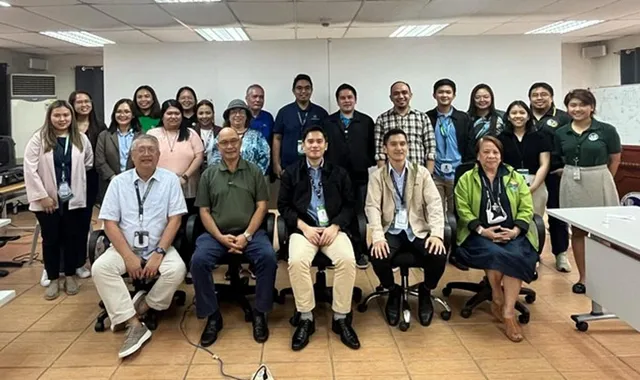
The Mines and Geosciences Bureau (MGB) participated in the Joint Consultation Meeting on High Conservation Value Area (HCVA) and Reference Ecosystem held at the MGB Multi-Purpose Hall, Diliman, Quezon City on January 23, 2025. The said meeting was also attended by representatives from the Ecosystems Research and Development Bureau (ERDB), Biodiversity Management Bureau (BMB), Forest Management Bureau (FMB), Biodiversity Corridor Project, and the USAID Sustainable Interventions for Biodiversity, Oceans and Landscapes (SIBOL) Project, with discussions focusing on policies and guidelines related to conservation and mine rehabilitation activities.

In his opening remarks, Engr. Marcial H. Mateo, Chief of the MGB - Mine Safety, Environment, and Social Development Division (MSESDD), underscored the importance of inter-agency collaboration in strengthening environmental policies, particularly in addressing conservation challenges within mining-affected areas.

During the meeting, For. Christian Kevin A. Latiza, Chief of the Mine Environmental Management Section, MGB-MSESDD, presented updates on the Draft Supplemental Guidelines on the 5% Reference Ecosystem (RE) requirement under DAO No. 2022-04, re: Enhancing Biodiversity Conservation and Protection in Mining Operations. For. Latiza also highlighted the issues and concerns identified during the initial implementation of the DAO, particularly the criteria and procedures for selecting REs. Participants agreed that there is a need to assess the implementation of RE establishment, with the results therein to be presented during a stakeholders' consultation with mining companies in the first quarter of 2025. This initiative aims to identify and address any gaps, issues, and concerns on the implementation of DAO No. 2022-04.

For. Paul J. Cuadra of ERDB – Forest Ecosystems Research Division presented the Draft Rehabilitation Guidelines for Mined-Out Areas, outlining an activity plan and a manual for mine rehabilitation. He emphasized the importance of conducting regional-level consultations, which are also scheduled for the first quarter of 2025. The preparation of the said rehabilitation guidelines is supported by the USAID-SIBOL Project.

Mr. Ryan A. Cuanan, OIC Chief of BMB-National Parks Division, shared insights on Sukat ng Kalikasan: High Conservation Values - Natural Capital Accounting on Protected Areas, focusing on integrating HCVA into conservation planning. It was agreed that ERDB would take the lead in developing the HCVA guidelines, ensuring alignment with existing environmental policies. BMB and MGB will also hold a separate meeting to discuss issues related to mining operations in protected areas, including other concerns that emerged during the consultation.

The joint consultation meeting reaffirmed the DENR’s commitment to strengthening environmental policies, through active engagement of MGB, FMB, BMB, and ERDB to support integrating conservation measures into mining regulations.

February 08, 2025

The Climate Change Commission (CCC) has reaffirmed the Philippines’ dedication to climate action through green economic pathways.

In a news release on Friday, the CCC said the '2025 Sustainability Forum: The Green Economies of Tomorrow' held on Jan. 31 gathered key figures from the government, business, and international organizations to fast-track the country’s transition to a sustainable, low-carbon economy.

“The private and public sectors are crucial partners in this transformation. The shift to renewable energy, electric vehicles, smart cities, and sustainable agriculture are all areas where we can advance,” Secretary Robert E.A. Borje, Vice Chairperson and Executive Director of the CCC, said.

He underscored the strong collaboration between these sectors would help drive investments in renewable energy, climate-resilient infrastructure, and green technologies.

During the forum, Borje reiterated the country’s commitment to reducing greenhouse gas emissions by 75 percent under its Nationally Determined Contributions (NDCs), a crucial target under the Paris Agreement.

He identified energy, transport, waste, industry, and agriculture as the key sectors driving the NDC Implementation Plan (NDCIP).

Meanwhile, Borje also underscored the importance of a just transition plan to ensure that the transition to a low-carbon economy is fair and inclusive, ensuring that workers and vulnerable communities equitably benefit from green economic policies without being left behind.

The forum, organized by the German-Philippine Chamber of Commerce and Industry (GPCCI) in collaboration with the German Embassy, provides a vital platform for fostering collective action and developing effective climate solutions.

GPCCI president Marie Antoniette Mariano said the forum is a space for meaningful dialogue, alignment of strategies, and strengthened partnerships to drive lasting impact.

The discussions also explored ways to align Philippine climate policies with international commitments while addressing local economic and social priorities.

Borje said the Philippines’ updated NDC, set to be released this year, would incorporate emerging technologies and evolving priorities, further scaling up both adaptation and mitigation efforts.

During the forum, he also encouraged strong collaboration and collective action among countries and stakeholders in realizing their climate ambitions of a climate-smart, climate-resilient, and low-carbon sustainable future.

February 08, 2025

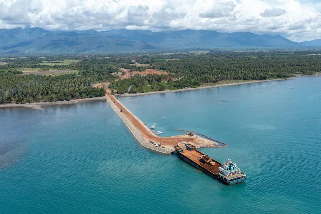
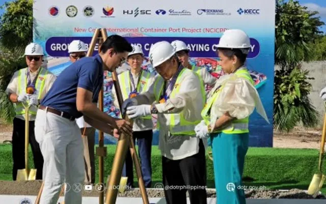
Construction of the New Cebu International Container Port (NCICP) broke ground on Wednesday to address cargo congestion at the Cebu Base Port and improve the turnaround of commercial vessels in the region.

Department of Transportation (DOTr) Secretary Jaime Bautista said the New Cebu International Container Port (NCICP) will address the current bottlenecks in the logistics chain, promote faster and more cost-efficient transport of goods, and enhance the competitiveness of local businesses and industries.

“This redistribution will pave the way for a seamless flow of goods and services, ensuring our economy remains robust and dynamic,” Bautista said during the groundbreaking rites for the NCICP in Barangay Tayud, Consolacion in Cebu.

Through the new cargo port, he said users will save money through reduced vessel waiting costs, reduced transport and congestion-related costs, and increased income from land leases.

“The benefits of this project extend far beyond its physical structure. It is expected to generate a wide array of advantages for users, the local community, and the public sector,” he said.

Aside from cost savings, its benefits include job creation, more opportunities for local businesses, development of regional industries, improved competitiveness of local industries, and establishing Cebu as a regional logistics hub.

On the other hand, he said the national and local governments will benefit through increased tax revenues and environmental cost savings due to better operational efficiency.

The PHP16.93-billion cargo port project is implemented through an official development assistance (ODA) scheme from the Export-Import Bank of Korea (KEXIM) and transaction adviser International Finance Corporation of the World Bank.

The NCICP will be completed by the second quarter of 2028 and will be built on a 25-hectare reclaimed island with a 500-meter berth length and a negative 12-meter water depth.

It will be capable of serving two 2,000 twenty-foot equivalent unit (TEU) vessels at the same time using five quay cranes, and with an access road of 1,365 meters to connect the port through the 300-meter offshore bridge.

Improving PH-Korea economic ties

The project, meanwhile, is seen to significantly boost economic engagement between the Philippines and South Korea, especially with the bilateral free trade agreement (FTA) already in effect, according to the Korean Embassy in Manila.

“Since Korean tourists are the Philippines top visitors, and with the entry into force of the Korea-Philippines FTA on December 31, trade and cargo volumes between the two countries are expected to increase significantly in the future,” the Korean Embassy said in a statement.

“The NCICP is expected to be an important base for economic cooperation and people-to-people exchanges between the two countries,” it added.

In his remarks, South Korean Ambassador to the Philippines Lee Sang-hwa said he expects the project to transform Cebu into a “key maritime hub in Southeast Asia”.

“The construction of the new port is expected to significantly improve Cebu's cargo handling capacity and logistics efficiency, attract investment, and have a positive ripple effect not only on Cebu but also on the entire Visayas region,” said Lee, adding that it serves as an “important step towards shared prosperity between the two countries.”

The groundbreaking was held just over a month after the signing of the civil works contract for the Cebu New Port Project at Malacañang Palace on Dec. 18, 2024, in the presence of President Ferdinand R. Marcos Jr.

Both Bautista and Cebu Governor Gwendolyn Garcia expressed their gratitude for Korea's continued support and cooperation for the development of the Philippines, and emphasized the project’s positive impact on improving the quality of life of Filipinos.

The groundbreaking is a follow-up to last year's Philippine-Korea bilateral summit, which elevated the relationship to a strategic partnership.

February 08, 2025

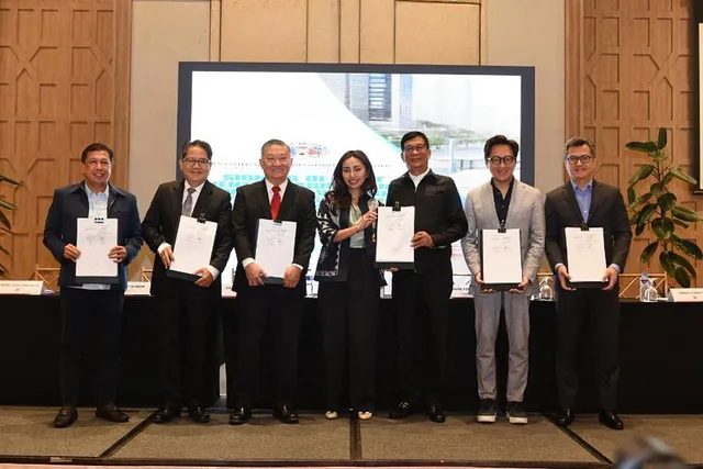
Megawide and Maplecrest Group, Inc. (MGI), through their joint venture Cavite Rapid Transport, Inc., have officially signed the contract for the Cavite Bus Rapid Transit System (CBRT) with the Provincial Government of Cavite. The signing took place on January 27, 2025, at Twin Lakes Hotel, Batangas.

Megawide Chairman and CEO Edgar Saavedra highlighted the project’s transformative potential, stating, “The initial phase of CBRT will serve 10,000 daily passengers, with a target five-fold increase in three years. This is part of our commitment to delivering world-class infrastructure for Filipinos.”

Enhancing Mobility in Cavite

The CBRT, structured under a 30-year Build-Operate-Transfer agreement, will establish a 29-kilometer bus transit system designed to accommodate up to 80,000 daily passengers at full capacity. The project, valued at P1.87 billion, will be developed in two phases:

  • Phase 1: Three terminals, 27 stations, and a Bus Rapid Transit (BRT) and Point-to-Point (P2P) system serving Kawit, Imus, General Trias, and Tanza.
  • Phase 2: One terminal, 20 stations, and an extension to Trece Martires, linking with the Parañaque Integrated Terminal Exchange (PITX) and Metro Manila business districts.

Construction begins in Q1 2025, with Phase 1 operations expected by Q3. Full project completion is targeted for 2028.

A Modern Public Transport Solution

Designed for speed and reliability, the BRT system will operate on dedicated lanes with scheduled trips to ensure reduced congestion and faster travel times. Strategically located stations will enhance accessibility and commuter convenience.

Strengthening Connectivity with Lancaster New City

A key portion of the CBRT will traverse the spine road of Lancaster New City, an MGI subsidiary project. MGI Chairman Guillermo Choa emphasized the project’s alignment with their advocacy to uplift community mobility.

With Megawide’s expertise in transport infrastructure, the CBRT aims to enhance Cavite’s connectivity to Metro Manila, ease congestion, and drive economic growth—aligning with Megawide’s vision of engineering a First-World Philippines through innovative solutions.

February 07, 2025

The 5th edition of Geo Connect Asia (GCA) celebrates the mainstreaming of geospatial solutions across government, enterprise and non-profit, with a record number of participants on the show and supporting conferences.

Following the theme of Geospatial driven impacts: underground, land and sea to sky, the event looks to attract more than 120 companies and 3000 visitors and delegates.

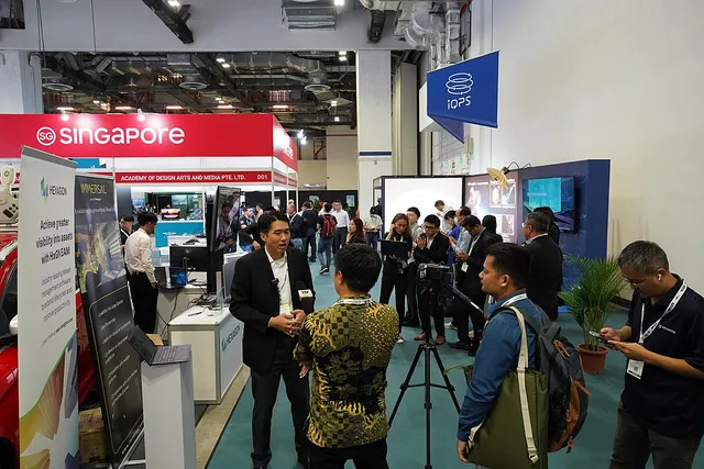
GCA 2025 will be held on the 9th & 10th April in Sands Expo & Convention Centre in Singapore. The show will be co-located with Digital Construction Asia, Drones & Uncrewed Asia and Marine & Hydro Asia.

The growing influence of AI, robotics, data interoperability and security across industries will be the main theme of the Geo Autonomy Summit (formerly Geo Connect Asia Conference).

Leading speakers include:

  • Thomson Lai, Managing Director, Digital, AECOM
  • Will Cavendish, Global Digital Services Leader, Arup
  • Philipp Kandal, CTO, Grab
  • David Foo, Assistant Chief Executive Operations and Ops-Tech / Chief Data Officer, Maritime and Port Authority of Singapore (MPA)
  • Ms Salote Viti, Chairwoman, Pacific GIS & Remote Sensing Council

View speakers & programmes here: https://tinyurl.com/GCA2025ConferenceBrochure

Supporting conferences include the return of Digital Underground Connect and the respective launches of the Digital Construction Asia Forum and APAC Earth Observation Forum.

The growing regional impact of the event is reflected by group pavilion support from Indonesia, Sabah, Singapore and Thailand. The Organisers are also looking to increase regional attendance beyond 40% of the total, up from 32.5% in 2024.

Commenting on the growing regional reach of Geo Connect Asia, Rupert Owen, Co-founder of Geo Connect Asia says ‘’We are delighted to expand the footprint of the region’s geospatial knowledge base and share common experiences. The vulnerability of ASEAN countries to climate-induced challenges, the dynamics of urbanisation and the need to actively manage limited resources demands response from planners, operators and industry specialists. Supported by the latest geospatial solutions there is a growing belief in technology-enhanced answers to some of the most pressing challenges. Sharing these experiences is the focus of Geo Connect Asia as the regional community hub.’’

Register for the conference pass to gain access to valuable industry insights. Visit www.connect.geoconnectasia.com/regpage to secure your preferred pass. Early Bird Discounts for conference registration are available until 21st March 2025, offering a limited-time opportunity to register at a reduced rate. CPD points are available upon application.

Supported by the Singapore Land Authority, Geo Connect Asia is organised by Montgomery Events Asia. The event’s parent company, the London-based Montgomery Group, will celebrate its 130th anniversary in 2025.

About Geo Connect Asia 2025

Geo Connect Asia 2025 specifically focuses on bringing the industry together for two days of face-to-face discussions and networking on the 9th & 10th April 2025 in Halls B & C, Sands Expo & Convention Centre, Marina Bay Sands in Singapore. The event will provide

a collaborative business meeting platform for industry professionals from across South-East Asia and beyond. Discover how geospatial solutions and location intelligence can take your business to new heights and meet and network with more than 3,000 industry professionals in person, all sharing a collective vision of the global geospatial community.

The show of more than 100 companies offers a wide range of solutions to assist in the delivery of projects, applying the latest in surveying, remote sensing, location-based and operational solutions. Leading sponsors include Trimble (Gold), Emesent (Silver), Cupix, Fugro and YellowScan (Conference Sponsors).

For further information visit: https://www.GeoConnectAsia.com

February 03, 2025

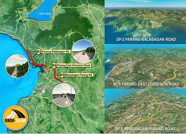
The Department of Public Works and Highways (DPWH) continues to engage key stakeholders to ensure the effective completion of the detailed engineering design and construction phases for the Road Network Development Project in Conflict-Affected Areas of Mindanao (RNDP-CAAM).

DPWH Senior Undersecretary Emil K. Sadain, chairperson of the RNDP-CAAM Steering Committee, led a meeting on January 30, 2025 in Cotabato City that focused on discussions of anticipated challenges and updates on progress of the project, emphasizing its importance not only for improving transportation networks but also for its broader implications on peace-building and economic growth in Mindanao.

RNDP-CAAM is a transformative project under implementation of DPWH Unified Project Management Office - Roads Management Cluster 1 (UPMO-RMC 1) involving the construction 80.97 kilometers of new national roads in four (4) sub-projects with a specific focus on enhancing connectivity between Bangsamoro Autonomous Region in Muslim Mindanao (BARMM) and neighboring regions.

The project is supported by the Japan International Cooperation Agency (JICA) Loan Agreement PH-FP1 and is part of the national government’s larger effort to create a more integrated and prosperous Mindanao, promoting both infrastructure development, peace-building, and socio-economic opportunities for local communities.

Formed through a DPWH Special Order 58 series of 2023 and tasked by Secretary Manuel M. Bonoan to oversee the conduct of the overall work in accordance with the project design activities and implementation plan, the Steering Committee is composed of representatives from various national government agencies, BARMM Ministries and local government units, and with the support of JICA.

Senior Undersecretary Sadain explained that the RNDP-CAAM is set to become one of the most significant infrastructure legacy of the President Ferdinand R. Marcos Jr. administration in Mindanao.

“This project embodies the government’s commitment to not only improving physical infrastructure but also fostering an environment of peace, collaboration, and opportunity”, said Senior Undersecretary Sadain.

Key participants of 4th Steering Committee Meeting held at the Conference Room of PICE Cotabato - Maguindanao Chapter Building, Cotabato City included: DPWH Roads Management Cluster 1 - Bilateral, UPMO Project Director Benjamin A. Bautista; BARMM Ministry of Public Works OIC Minister Danilo A. Ong; JICA Project Formulation Advisor Ms. Yoko Katakura; DPWH Stakeholders Relations Service Director Randy R. Del Rosario; DPWH Regional Project Management Office (RPMO) - BARMM OIC Project Director Eileen Diya; Dr. Jovito C. Santos from consulting firm CTI Engineering International Co., Ltd. - Oriental Global Co. Ltd. (Joint Venture); Regional Director Joel Q. Mamon of the Office of Civil Defense - Bangsamoro Autonomous Region; Brigadier General Nasser Lidasan, Chairperson of the Government of the Philippines Coordinating Committee on the Cessation of Hostilities (CCCH); Philippine Navy 1st Marine Brigade Deputy Commander Col. Zaldy Dionida; Mr. Omar Bayao of the Moro Islamic Liberation Front - CCCH; DPWH RPMO Project Managers Reyderick M. Siozon and Herodin A. Edris; UPMO RMC 1 Engr. Neijam Langa; Bureau of Design Engr. Joary A. Cervantes; as well as representatives from the local governments of Sultan Kudarat, Parang, and Matanog. Additional attendees included key personnel from the BARMM Ministry of Environment, Natural Resources and Energy (MENRE) and the Ministry of Agriculture, Fisheries, and Agrarian Reform (MAFAR).

The meeting underscored the importance of collaboration among government agencies, local officials, and communities in addressing early concerns related to right of way acquisition and ensuring security and safety from lawless elements to safeguard the integrity of the project and protect its workers and assets from any disruptive forces.

“As we embark on the civil works implementation this CY 2025 of the RNDP CAAM, I appeal to our local government units to lend their full support to the national government in this critical undertaking. This is truly a golden opportunity for peace and development in the region, and it is through our collective efforts that we can ensure its success”, added Senior Undersecretary Sadain.

One (1) completed component of RNDP-CAAM is the 19.6-kilometer Marawi Transcentral Road, which was constructed under four (4) contract packages with a total cost of ₱744.589 Million. Finished in 2024, the road improved connectivity to Marawi City which is a central hub in Lanao Del Sur and is highly significant to the recovery and rebuilding efforts following years of conflict.

Meanwhile, actual civil works for the ₱1.379 Billion Parang East Diversion Road or Sub-Project 8 are expected to begin in the first quarter of 2025. The contract for the two (2)-lane, 7.07-kilometer road, which includes four (4) bridges in the municipality of Parang, was approved by Secretary Bonoan in December 2024. The project is now awaiting JICA’s concurrence and the issuance of the notice to proceed.

Procurement for the civil works contractor is currently ongoing for the ₱3 Billion Sub-Project 9, the 17.57-kilometer Manuangan-Parang Road, which includes two (2) bridges. This vital road project aims to improve the movement of goods and people, unlocking new economic opportunities for the communities in Parang, Sultan Mastura, and Sultan Kudarat in Maguindanao del Norte, as well as Pigkawayan in North Cotabato. The bid submission took place on January 28, 2025, and is now under review and evaluation by the DPWH Pre-Qualification, Bids, and Awards Committee.

Lastly, the detailed engineering design plans for Sub-Project 2, the 36.73-kilometer Parang-Balabagan Road with 16 bridges, are currently awaiting approval before moving to the procurement stage.

With an estimated cost of ₱6.898 Billion, the Parang-Balabagan Road will be implemented in four (4) contract packages. This key project will significantly enhance connectivity between the towns of Parang and Matanog in Maguindanao del Norte, as well as the municipalities of Kapatagan and Balabagan in Lanao del Sur. It will improve trade and mobility, benefiting local communities and supporting regional development.
February 03, 2025

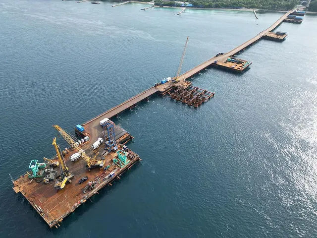
The Department of Public Works and Highways (DPWH) is making significant progress on the 4.76-kilometer Samal Island-Davao City Connector (SIDC) Project, which will link Davao City and Samal Island with a four (4)-lane extradosed bridge.

In his latest inspection report to DPWH Secretary Manuel M. Bonoan, Senior Undersecretary Emil K. Sadain highlighted the steady progress of the project, with the overall physical accomplishment at 11.87%, and a positive slippage of 4.35%.

The bridge’s foundation works are advancing as planned, and the SIDC project is on track to meet its completion deadline by September 2028.

Senior Undersecretary Sadain, during his site visit on January 28, 2025 alongside Project Director Rodrigo I. Delos Reyes of the Bridges Management Cluster-Unified Project Management Office (BMC-UPMO) and Stakeholders Relations Service Director Randy R. Del Rosario, underscored the importance of adhering to safety protocols. This is particularly crucial as piling works are underway at the Pakiputan Strait, an area with active marine traffic, while land viaduct construction is intensifying.

The DPWH SIDC Project Team, led by Project Manager Joweto V. Tulaylay and Project Engineer John Christian T. Gaden, assured that the design-and-build contractor, China Road and Bridges Corporation, and project consultant Pertconsult International are diligently following safety measures to protect workers and passing vessels. Environmental precautions are also a priority to mitigate any adverse impacts on the surrounding areas, with careful handling of equipment and materials.

The project will feature two (2) lanes in each direction, as well as ramps, roundabouts, and both marine and land viaducts. The bridge will have a 275-meter main span, two (2) pylons standing 73 meters above sea level, and a 1.62-kilometer marine crossing, further cementing its role in improving regional connectivity.

According to Senior Undersecretary Sadain, this pivotal infrastructure development aligns with President Ferdinand Marcos Jr.’s Build Better More program and his vision of Bagong Pilipinas, aiming to improve connectivity nationwide by providing essential transportation links that will significantly enhance the quality of life for Filipinos.

Work on the project is progressing steadily, with significant milestones reached in the bored piling activities for both the land and marine viaducts. As of now, 73 out of 110 piles for the land viaduct on the Davao City side have been completed, while all 74 piles for the Samal Island side land viaduct are finished. For the navigation bridge, 13 piles have been completed on the Davao side, and 11 piles have been completed on the Samal side.

Additionally, work on the R. Castillo approach ramp has started, with 7.5% of the 133 bored piling already finished.

Land acquisition for the project is also progressing well with 71% of the required land in Davao City acquired through negotiated sale, while the remaining lots are in process and expropriation efforts are underway. Notably, 88% of affected lots on the Davao side and all lots on the Samal side have been turned over to the DPWH. Additionally, 92% of the affected coconut trees and 90% of the timber trees have been acquired.

The P23.52 billion project is funded through an Official Development Assistance (ODA) loan from China and is part of a broader national effort to enhance connectivity, alleviate traffic congestion, and boost regional economic development.

Once completed by 2028, the bridge is expected to significantly improve access to Davao City and Samal Island, driving growth in tourism and economic activity across the region, said Senior Undersecretary Sadain.
February 03, 2025

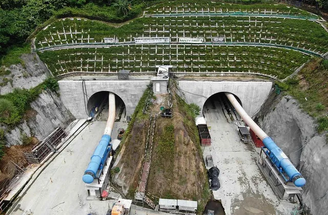
Embassy of Japan in the Philippines Ambassador Kazuya Endo and Department of Public Works and Highways (DPWH) Senior Undersecretary Emil K. Sadain inspected on Monday, January 27, 2025, the ongoing road mountain tunnel component of the Davao City Bypass Construction Project, a flagship infrastructure initiative aimed at alleviating traffic congestion and significantly enhancing connectivity across Davao City and neighboring areas.

Accompanying Ambassador Endo were his wife, Akiko, Consul-General of Japan in Davao Yoshihisa Ishikawa, 1st Secretary Kurihara Shinobu, 2nd Secretary Akito Kinoshita, and 3rd Secretary Ryouske Saka. DPWH Senior Undersecretary Sadain was joined by Unified Project Management Office (UPMO) Project Director Benjamin A. Bautista of Roads Management Cluster 1 and Project Director Rodrigo I. Delos Reyes of Bridges Management Cluster, and Stakeholder Relations Service Director Randy R. Del Rosario. Additionally, DPWH Roads Management Cluster 1 - Bilateral, UPMO staff included Project Manager Lope L. Pajarillaga Jr., Project Manager Emmanuel A. Regodon, Engineer Earl Nicholas F. Rada, and other technical engineers.

According to Senior Undersecretary Sadain, the centerpiece of the 10.7-kilometer contract package I-1 of the 45.5-kilometer Davao City Bypass Construction Project is the 2.3-kilometer road mountain tunnel, which once completed, will be the longest tunnel in the Philippines.

The inspected road mountain tunnel feature a two (2) separate tubes for northbound and southbound traffic, improving both safety and traffic flow. This twin tunnel is crucial for cutting through the mountainous terrain, providing a direct and safer route for motorists.

Excavation for the northbound tunnel is over 95% complete, while the southbound tunnel is more than 85% finished. A tunnel breakthrough, a long-awaited event which brings to an end the most critical phase of tunnelling, is expected by the second quarter of 2025, said Senior Undersecretary Sadain.

Davao City Bypass Construction Project is financed in part by the Government of Japan thru Japan International Cooperation Agency (JICA), which continues to play a vital role in supporting the Philippines’ infrastructure ambitions.

With the continued support of Japan through JICA, DPWH is on track to finish this major infrastructure project within the term of President Ferdinand R. Marcos Jr., further advancing his vision for sustainable development and improved quality of life for all Filipinos.

The project is in line with the administration’s “Build, Better, More” program, a key component of the Philippine Development Plan which aims to enhance national connectivity to promote economic growth, and improve transportation efficiency for both people and goods across the country.

As part of this initiative, President Marcos has earlier tasked DPWH Secretary Manuel M. Bonoan with prioritizing critical infrastructure projects that will drive economic progress and make a significant impact on the lives of Filipinos such as the Davao City Bypass Construction Project.

Once completed, the Davao City Bypass Construction Project will reduce travel time between Toril and Panabo City from 1 hour and 44 minutes to just 49 minutes, helping to alleviate traffic congestion and boost productivity. The project will also stimulate economic activity, opening up new opportunities for trade, tourism, and business, while creating thousands of jobs.

The completion of the project will be a game-changer for Davao’s infrastructure, driving the growth of new economic hubs, raising land values, and solidifying Davao’s position as a key regional growth center in Mindanao.

JICA’s expertise in planning, design, and construction has been instrumental in the development of several infrastructure projects in the country that make it easier for people to move around.
February 03, 2025

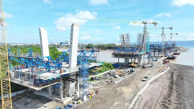
The Department of Public Works and Highways (DPWH) is making significant progress on the construction of 1.34-kilometer Davao River (Bucana Bridge) with the overall completion rate stands at more than 73% and target to be completed by the third quarter of 2025.

During a site inspection on January 27, 2025, Senior Undersecretary Emil K. Sadain accompanied by Project Director Rodrigo I. Delos Reyes of the Bridges Management Cluster-Unified Project Management Office (BMC-UPMO), observed substantial progress on the project with current activities now centered on the bridge’s superstructure.

Also participating in the inspection are UPMO Roads Management Cluster 1 Project Director Benjamin A. Bautista, Stakeholders Relations Service Director Randy R. Del Rosario, and UPMO Project Manager Joweto V. Tulaylay.

The bridge will connect the eastern and western coastal areas of Davao City, providing a major alternate route to alleviate traffic congestion in the city center and improving access to key areas across the metropolis.

In his update to Secretary Manuel M. Bonoan, Senior Undersecretary Sadain highlighted that the DPWH BMC-UPMO Bucana Bridge Project Team, led by Acting Project Manager Norifel Teddie G. Cadiang and Project Engineer John Christian T. Gaden, is intensifying construction to meet ahead of the target completion date by the end of November 2025, marking 24 months since notice to proceed was issued to contractor China Road and Bridge Corporation (CRBC).

“Although recent rains in Mindanao have posed some challenges, we are confident that the Bucana Bridge will be finished ahead of schedule. Our project engineers and the contractor are committed to expediting the work,” said Senior Undersecretary Sadain.

The Bucana Bridge is a four-lane, six-span extradosed bridge with advanced structural features, designed to complement the Davao City Coastal Road. It will significantly enhance mobility and connectivity within the greater Davao area.

With a total contract cost of ₱3.126 Billion, the project is funded under a China Aid Grant complemented by funding from the Philippine government and incorporates a modern design that allows for navigational clearances, ensuring the smooth passage of maritime traffic along the Davao River.

Once completed, the Bucana Bridge will accommodate up to 35,000 vehicles daily, improving traffic flow and reducing congestion in Davao City’s coastal areas.

January 27, 2025

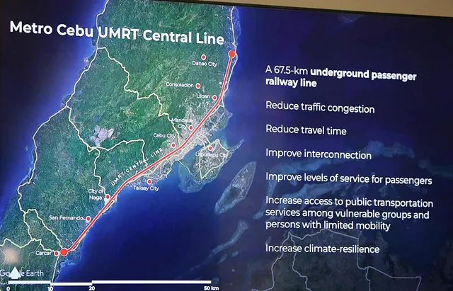
The Department of Transportation (DOTr) is looking into the construction of an underground rail line in Cebu province to help address vehicular traffic.

In an interview over Radyo Pilipinas on Thursday, DOTr Undersecretary for Planning and Project Development Timothy John Batan said such a project was first discussed with Cebu Governor Gwendolyn Garcia in 2024 and conceived as part of the DOTr’s masterplan to decongest Cebu roads through public transport.

“Dadaan pa ito sa feasibility study. Isa po sa direksyon nating tinatahak ang involvement ng provincial government ng Cebu nang sa ganun ay maging tugma at angkop sa pangagailangan ng mga taga Cebu (This will still go through a feasibility study. The direction we’re looking at is to involve the provincial government of Cebu to ensure the project will address the needs of the locals),” Batan said.

He said Cebu’s narrow roads make elevated rail lines not feasible and why they are eyeing a subway instead.

“Puwede po pero napakahirap. Magiging baku-bako at liku-liko masyado ang magiging alignment ng ating riles (It is possible but it would be too difficult. The railway alignment will not be right),” Batan said.

Under the DOTr’s Cebu masterplan, the subway will connect Danao City to Carcar City through 50 to 65 kilometers of rail line.

The project’s feasibility study is currently looking into the number of passengers the subway should be able to accommodate. By Raymond Carl Dela Cruz


Article courtesy of the Philippine News Agency

January 27, 2025

Ipilan Nickel Corporation (INC), the operating arm in Palawan of diversified conglomerate Global Ferronickel Holdings Inc. (FNI), is off to a fast start in 2025 as it has begun shipment of nickel ore to China. MV Maple Unity left the INC anchorage area in Brooke’s Point last January 17, 2025, carrying 60,117 wet metric tons (WMT) of Ni 1.40 % medium-grade nickel ore. With the current pace and weather permitting, INC expects to be able to ship a total of 40 vessels in 2025 with a projected sales mix of 52% medium-grade nickel ore and 48% low-grade nickel ore.

“We are happy to report that INC’s operations are in full stride and the increase in activity is part of our long-term plans that is why we have applied, as early as last year, for the amendment of our Environmental Compliance Certificate (ECC) that will boost INC’s production level limit from 1.5 million WMT to 3 million WMT,” FNI President Dante R. Bravo said.

Once granted, the increase in production levels will result in more employment opportunities, higher contribution to the Social Development Management Program (SDMP) fund, increase in royalty shares for the Indigenous Peoples in the host and impact barangays, and higher tax revenues for the government.

INC, which operates a Mineral Production Sharing Agreement (MPSA) with the government, holds the exclusive right to conduct mining operations in the Municipality of Brooke’s Point, Palawan covering 2,835 hectares, of which 260 hectares have been partially declared as a mining area. It secured its Certificate Precondition from the National Commission on Indigenous Peoples (NCIP) in 2024 and is in the process of renewing its business permit from the local government which has been very supportive of INC’s operations. INC continually strives to work together with all relevant stakeholders to achieve sustainable development and maximize the benefits of responsible mining.

January 20, 2025

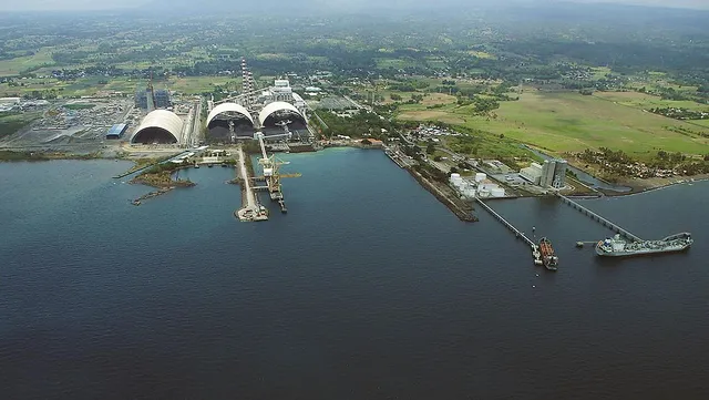
Semirara Mining and Power Corp. (SMPC), the country’s largest coal miner, continued to post record-high shipments for two straight years in 2024, with local and outbound shipments of 16.5 million metric tons (MT).

SMPC reported Tuesday that coal shipments increased by 15.8 million MT in 2023.

“For the third consecutive year, we have hit our maximum coal production of 16 million metric tons under our existing Environmental Compliance Certificate (ECC). This milestone underscores the SMPC team’s dedication and commitment to meet rising local and global energy demand,” SMPC president, chief operating officer and chief sustainability officer Maria Cristina Gotianun said in a statement

Stronger demand from China boosted SMPC’s outbound coal shipment last year, with exports to China reaching 7.6 million MT, up by 46 percent.

Ninety percent of SMPC’s foreign shipments in 2024 went to the East Asian country.

Total coal exports of the listed firm last year reached 8.4 million MT, increasing by 4 percent.

Domestic shipments of SMPC, likewise, improved by 4 percent to 8 million MT due to higher sales to local cement companies and Calaca power plant.

SMPC mentioned that 20 percent of the 1.3 million MT sold to cement production facilities were supplied to its sister company Cemex Holdings Philippines, Inc., which was recently bought by their parent firm, DMCI Holdings, Inc.

“While we anticipate market prices to further normalize in 2025, we remain focused on strengthening our customer network and enhancing operational efficiencies to effectively support national energy security and meet the growing demand from the industrial and cement sectors,” Gotianun added. By Kris Crismundo


Article courtesy of the Philippine News Agency

January 20, 2025

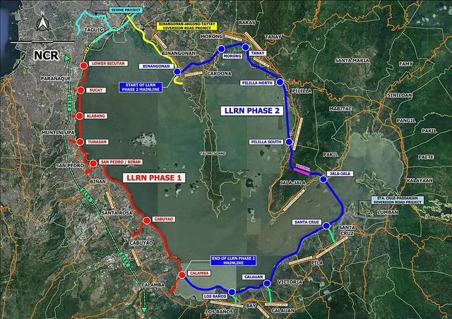
The Philippine government has secured an official development assistance (ODA) loan from the Republic of Korea, through the Export-Import Bank of Korea (KEXIM), for the Laguna Lakeshore Road Network (LLRN) Project Phase 1 Stage 1, the Department of Public Works and Highways (DPWH) reported on Saturday.

The loan, valued at USD905.26 million, will support civil works implementation by the DPWH of the flagship project under the Build Better More program of President Ferdinand R. Marcos Jr.

Civil works for the LLRN Project are set to begin this year, with completion anticipated by 2029.

The project is expected to significantly enhance economic productivity and foster positive change in the Calabarzon Region and the broader National Capital Region.

The ceremonial exchange of the loan agreement took place Friday at the Department of Finance (DOF) press briefing room in Manila.

It was attended by KEXIM executive director Um Sung-Yong, DPWH Secretary Manuel Bonoan, Korea’s Ministry of Economy and Finance First Vice Minister Kim Beom-Seok, and DOF Undersecretary Joven Balbosa.

In a statement, Bonoan expressed gratitude to KEXIM for its ongoing partnership in supporting the Philippines’ infrastructure development goals.

He also highlighted the importance of the LLRN Project in enhancing connectivity and economic opportunities, particularly in the Luzon economic corridor, a vital region for national growth and regional integration.

Meanwhile, DPWH Senior Undersecretary Emil Sadain, who oversees the agency’s flagship infrastructure projects, emphasized that the road project in the shorelines of the Laguna Lake will address severe traffic congestion in the area, including a portion of the South Luzon Expressway.

The multimillion-dollar project aims to provide safer, faster, and more convenient travel, boosting tourism development and economic growth in the surrounding areas of Metro Manila, Laguna, Rizal, Cavite, and Batangas.

The Phase I Stage 1 includes a 7.94-kilometer road, consisting of 6.81 kilometers of viaduct/bridge and 1.13 kilometers of embankment, along with three interchanges, along with 1.92 kilometers of slip roads.

“This transformative project marks a major milestone in our long-term vision to create a sustainable, resilient, and efficient road network that will benefit generations of Filipinos,” Sadain said.

The DPWH Unified Project Management Office - Roads Management Cluster II will lead the implementation of the project, with support from Korean experts who will oversee construction supervision during Stage 1. By Ferdinand Patinio


Article courtesy of the Philippine News Ageny

January 20, 2025

President Ferdinand R. Marcos Jr. has signed into law a measure establishing a framework for the development of the country’s natural gas industry.

Marcos signed Republic Act (RA) 12120 or the Philippine Natural Gas Industry Development Act on Jan. 8, a copy of which was uploaded to the Official Gazette on Tuesday.

The new law seeks to establish the Philippine Downstream Natural Gas Industry and increase the share of natural gas in the country’s energy mix by promoting it as a safe, efficient, and cost-effective source of energy and an indispensable contributor to energy security.

Likewise, RA 12120 offers incentives to boost investments in the Philippine natural gas industry by allowing the entry of investors under a system of competition, transparency and fair trade, and by providing responsive policy support, with the end goal of attaining low cost energy prices pursuant to RA 7638 or the Department of Energy Act of 1992.

The new law is also seen to help the Philippines meet the increasing local demand for fuel, and develop the country as a Liquefied Natural Gas (LNG) trading and transshipment hub within the Asia-Pacific Region.

Under the Marcos administration, the government has adopted a more aggressive stance to increase renewable energy in the country.

‘Significant step’

Senator Pia Cayetano thanked President Marcos for signing the landmark legislation, saying “this is a significant step toward energy security.”

“By enacting the Natural Gas Industry Development Act, we move closer to our vision of a more energy-secure Philippines that harnesses its own natural resources for the benefit of the Filipino people,” Cayetano said in a news release.

“With this law, we empower families, we empower the Filipino people."

Cayetano, chairperson of the Senate Energy Committee, said she principally authored and sponsored the bill in the Senate.

Citing the stability and generally lower prices of indigenous natural gas compared to the volatility of imported sources, Cayetano said securing a steadier, more reliable local supply will reduce the country’s vulnerability to global disruptions and address future energy demands.

"With more than half of our energy requirements being imported, we are clearly vulnerable to geopolitical conflicts," she said. By Darryl John Esguerra


Article courtesy of the Philippine News Agency

January 20, 2025

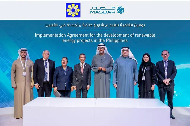
Emirati state-owned company Masdar has formalized its investment plans worth USD15 billion in the Philippines’ renewable energy (RE) sector by signing an Implementation Agreement with the Department of Energy (DOE).

The DOE announced Thursday that Undersecretary Rowena Guevara and Masdar chief executive officer Mohamed Jameel Al Ramahi signed the Implementation Agreement for the development of RE projects in the Philippines in Abu Dhabi on Jan.15.

It was witnessed by DOE Secretary Raphael Lotilla and UAE Minister of Industry and Advanced Technology and Masdar chairman Dr. Sultan Al Jaber.

The Implementation Agreement is the first deal forged between the Philippines and UAE following the signing of the Memorandum of Understanding (MOU) on Energy Transition Cooperation in November 2024 during President Ferdinand R. Marcos Jr.’s official working visit to the Middle East country.

“Building on the longstanding ties between the Philippines and the UAE, and the recent Energy Transition Cooperation, this partnership with Masdar marks a transformative step in our renewable energy journey,” Lotilla said.

“Under President Marcos Jr.’s leadership, the Philippines is integrating renewable energy into its energy mix on an unprecedented scale, ensuring energy security while fostering sustainable economic growth and environmental stewardship. This collaboration sets a new benchmark for energy transition in the region."

Under the RE agreement between DOE and Masdar, the latter is eyeing to invest USD15 billion to develop at least 1 gigawatt (GW) of solar, wind, and battery energy storage system (BESS) by 2030, and scaling it up to 10GW within the decade. It will develop and oversee commercial, technical, financial, and environmental work streams.

On the other hand, the DOE will assist Masdar in conducting pre-development activities, technical studies, securing the necessary rights, gathering project information, and obtaining all required approvals and permits.

“By leveraging UAE’s world-class expertise in renewable energy and the Philippines’ abundant natural resources, this agreement will create jobs, drive low-carbon socio-economic progress and expand global renewable energy capacity in line with the UAE Consensus,” Al Jaber said. By Kris Crismundo


Article courtesy of the Philippine News Agency

January 20, 2025

President Ferdinand R. Marcos Jr. on Wednesday vowed to provide adequate funds for the construction of large dams in the country.

"The big dams. We need to have that," Marcos said during a meeting with National Irrigation Administration (NIA) officials in Malacañang, as quoted by the Presidential Communications Office (PCO) in a news release.

The President, who stressed the importance of establishing big dams not only for irrigation but also for other purposes, met with NIA officials to discuss the agency's strategic plans and projects for 2025.

NIA Administrator Eduardo Eddie Guillen presented to Marcos the agency's objectives to enhance irrigation efficiency, ensure continuous operation of existing irrigation service areas, and maintain current irrigated lands.

Guillen said NIA has plans to improve service roads along irrigation canals.

Under NIA's 2025 programs, activities and projects (PAPs), the agency allocated around PHP20.84 billion for the Pump Irrigation Sub-Program and PHP7.88 billion for Stage 2 of the Ilocos Norte-Ilocos Sub-Abra Irrigation Project (INISAIP).

About PHP2.49 billion would be earmarked for the Balog-Balog Multipurpose Project Phase II in Tarlac, while PHP99.5 million would be used for the Special Irrigation Sub-Program.

Guillen said the PAPs would incorporate technological interventions and modernization of irrigation systems to mitigate the effects of climate change.

Marcos said the government has enough savings to fund the irrigation projects, noting that there is around PHP22.882 billion in the 2025 General Appropriations Act.

The government is eyeing the completion of three to five big dam projects before Marcos' term ends in 2028. These include the Tumauini River Multipurpose Project in Cagayan Valley, the Panay River Basin in Panay Island, and other projects in the Ilocos Region.

These are on top of the more or less 20 medium-scale irrigation projects that the NIA aims to construct under Marcos' watch.

January 06, 2025

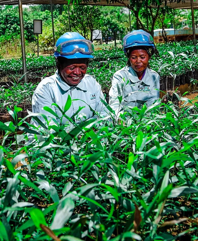
August 9 marked the celebration of the International Day of the World’s Indigenous Peoples. In conjunction with this observance, Taganito HPAL Nickel Corporation also honored the rich cultural heritage and foundational contributions of our ancestors, represented by our Indigenous Peoples.

The event emphasized the statement, “I’m a proud member of the Indigenous community and I belong to THPAL,” showcasing the pride and sense of belonging felt by the Indigenous workforce within the organization.

This event was dedicated to recognizing the valuable contributions of our Indigenous employees and their significant roles both in the company and the wider community.

THPAL has undertaken considerable initiatives to enhance employment opportunities for Indigenous communities in Claver, Surigao del Norte. Given that Indigenous Peoples are often underrepresented in the labor market, securing job opportunities, particularly within corporate sectors, has proven challenging for them.

By implementing inclusive hiring practices, THPAL guarantees that Indigenous applicants are included in the region's economic development. Historically, these communities have been constrained to the role of guardians of their ancestral lands. However, through THPAL's programs, they are now able to participate in the corporate workforce while preserving their unique cultural identities.

Indigenous peoples in the municipality of Claver are not merely recognized on this day; rather, they receive equal consideration and opportunities to express their identity and talents.

Each September, the municipality places significant emphasis on advocating for the Indigenous Peoples communities, providing them with a platform to display their distinct culture, traditions, and way of life.

This celebration serves not only as a platform for them to demonstrate their talents but also as a means for them to fully embrace their lives within the broader community, ensuring they have the same opportunities as other citizens.

In addition, last September 14, the Taganito HPAL Nickel Corporation held a signing of a Memorandum of Agreement (MOA) for 15 Indigenous People college students who will benefit as scholars of the educational initiative under the Social Development and Management Program (SDMP).

This initiative has been made to primarily assist and educate underprivileged members of the Indigenous People (Mamanwa) to pursue a college education, encouraging them to engage with the evolving society beyond their familiar environments.

By doing so, it empowers them to forge their paths and transform their perspectives on life, ultimately allowing them to elevate their social standing and improve their overall quality of life.

THPAL ensures that IP communities will be uplifted in manner that they will realize their dreams and will create lasting impact as individuals. This will also serve as an avenue to combat discrimination.

January 06, 2025

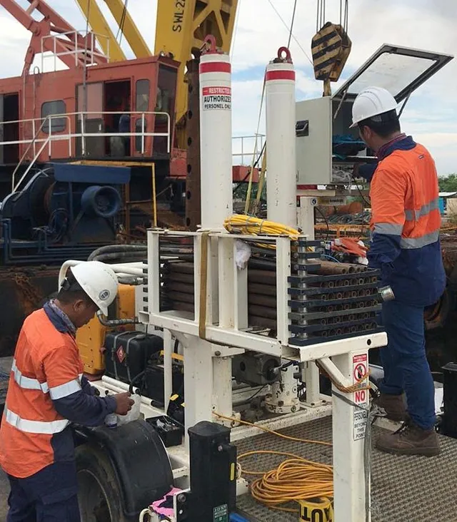
Geophysics has evolved into a leading discipline, providing invaluable insights in geotechnical, civil and mining engineering. 

Leading Geologist Tom Grace sheds light on the benefit of geophysical methods applied to engineering including geotechnical, civil, mining and water. His aim is to build an appreciation for geophysics and highlight the potential to significantly reduce risk, cost and schedule through proper ground profiling.

Geophysics for Engineering

Geophysics is the measure of the physical properties of the ground and the processes to quantify these properties. It is a transparent, auditable process with repeatable measurements.

Geophysics takes principles from physics, geology, and mathematics to measure, model and analyse the physical composition of the ground, from near to very deep below surface to investigate the subsurface structure, material properties and behaviour.

Geophysics applied to ground related engineering like geotechnical, civil, mining and groundwater enables engineers and contractors to search for anomalies in the composition of the ground, which is analysed through mathematics modelled against the anticipated geological profile. 

It is often an iterative process to calibrate the geophysical model against the geological interpretation.  This can reveal the previously unknown or unseen, prior to intrusive testing (drilling, CPT etc).

Geophysical methods commonly applied in engineering broadly comprises seismic, electro conductivity and radar-based surveys to map the subsurface. Gravity and magnetic surveys are less common in engineering applications.

Origins of Engineering Geophysics
Geophysical methods applications in civil and mining engineering are common now and since inception, gathering critical mass in the early 1970’s, originating out of large oil and gas projects. The people, technology and machinery to support these projects was brought in from mature markets overseas such as Europe.

The coal and mineral mining sector also began applying geophysical methods in the search for carbon-based fuels including coal and metalliferous deposits.  Geophysics was used extensively as it had great benefits, particularly when the NZ Government funded it to define the country’s available coal resources and investigate potential for converting coal to liquid fuel as an energy source.

Early Misunderstandings

Initial applications in engineering were possibly less successful due to the scoping and design not being appropriate, leading to inconclusive outcomes. This led to a belief that geophysical data could be easily interpreted, not recognising the complexities involved in data collection, processing and analysis.

With this misunderstanding, project expectations in the geophysics data were often highly backed by a strongly held perception that the Geophysical analyses were more accurate than they were.

In reality, geophysical data usually needs to be corroborated with other data sources, and there can be limitations and uncertainties.

Geophysics Resurgence

Modern Geophysical investigations are cost-effective and fast, especially when compared to the costs of traditional drilling or excavation. Many clients are now realising the potential savings of a mixed approach to ground analysis.

In practicality, different methods are suited for different geological conditions and objectives, requiring careful selection by a specialist Geophysicist. Validity of the method is re-emerging due to improved practice, guided by:

  • changes in regulations and codes which have changed the industry expectations of standard investigation methods.  
  • the growing body of work of geophysical practice in-field has consolidated as a reputable basis for ground analysis.  
  • mainstream practice and delivery have globalised through immigration of specialists;
  • expectations are more realistic.

Applications for Today

Geophysical methods and techniques today must be tailored to the setting and engineering problem. The main types applied in modern engineering applications are:

  1. Seismic Geophysics: Uses seismic waves to investigate subsurface structures. Common in oil and gas exploration, as well as earthquake studies.
  2. Electrical Resistivity Tomography (ERT): Measures the electrical resistivity of subsurface materials, useful for environmental assessments, groundwater studies.
  3. Ground Penetrating Radar (GPR): Uses radar pulses to image the subsurface, effective for locating buried objects, structures, and geological features.
  4. Downhole Geophysics: Uses various methods to measure a range of conditions for the ground once a borehole has been drilled. Common tools include optical and acoustic televiewers, sonic tools, natural gamma and density measurements.

Other methods not as common in our local market include:

  1. Gravity Surveying: Measures variations in the Earth's gravitational field.
  2. Magnetic Surveying: Detects variations in the Earth's magnetic field.
  3. Electromagnetic (EM) Methods: Measures the electromagnetic fields.

Why would I use Geophysics?

Put simply geophysics offers another diagnostic lens. It is not a definitive measure but another tool in the toolbox to understand what is happening below a broad land surface. Geophysical methods:

  • Save time and costs by providing critical information to target drilling or excavation.
  • Are non-intrusive and less invasive with a lower social footprint without the need for machinery.
  • Subsequently lowers costs as there is less remedial investment, it offers a small lighter footprint, less cost to the asset
  • Supply better coverage for equivalent cost. With increasing pressures on infrastructure investment Geophysics offers a high value-for-money business model.
  • Provide accurate, repeatable measurements subject to ISO equivalent quality assurance processes.
  • Are tested and proven from experience with growing body of experienced Geophysics practitioners.

How has Geophysics worked to provide solutions?

The benefits of geophysics are illustrated in these short case studies to show how Geophysics has helped delineate the problem and provide our client with a smart, cost-effective solution for the project:

Leakage Paths

Seepage paths were assessed in a flood bank control structure using Ground Penetrating Radar and ERT, which identify a likely leakage source and quickly targeted remedial works which were reduced.

The client had a flood mitigation structure that they knew occasionally leaked during high flow events. Potential sources could have focussed leakage along penetrations through the kilometres-long stop bank (tree roots, contact between material layers, unknown pipelines) or distributed leakage throughout the embankment (unsuitable fill or poor construction).

Ground Penetrating Radar and ERT were used to identify an anomaly within a few meters of the suspected leakage location. Two methods measuring different parameters were used to increase confidence in the interpretation. As a result, physical remedial works were reduced and focussed directly on the identified anomaly.

Stopbanks

During Cyclone Gabrielle, stopbanks (flood control dykes) in Hawke’s Bay, New Zealand were damaged and breached. At one specific breach (approx. 200m wide), geophysical investigation and interpretation to assess the likely ground conditions was used as the basis for a risk-based remediation approach. 

There was potential for the repaired stopbank to leak through the foundation materials. A suggested repair option involved a cut off wall down to a low permeability layer. Geophysical methods were rapidly deployed as a preliminary assessment tool and showed that there was no impermeable layer close to surface. The screening approach gave confidence in the ground model to confirm the risks for preliminary design without delay.  Changes were made to the stopbank geometry to reduce the risk of leakage from an informed position.

How do I go about using it?

When choosing a supplier to deliver your Geophysical investigation, ensure you select them with a clear understanding of their capabilities. Take time to understand the quality of machinery and tools, check track records and review the experience of nominated staff. It is a highly specialised service which can be easily misunderstood; partner with a proven specialist to give yourself the best chance of success.


Tom Grace - BSC MAusIMM Chartered Professional Geology

Tom Grace is one of the Principal Geologists at RDCL with over 20 years of experience in the industry. Tom has been working across the RDCL network in New Zealand and Asia for over 16 years, with a background in Project Geology across NZ, Australia and Canada. Tom is a graduate of the University of Canterbury Geology programme.

January 06, 2025

Mixed Reality (MR) solutions have revolutionized how infrastructure projects are designed, managed, and executed. With the integration of advanced software tools, professionals in the civil engineering field can leverage Bentley Systems' suite of applications to enhance infrastructure project outcomes.

Key Components of Bentley Systems’ Mixed Reality Solutions

Reality Modeling

  • iTwin Capture: Capture real-world conditions through high-resolution imagery and 3D photogrammetry technology. Convert point cloud data into detailed 3D models, enabling accurate representation of existing conditions.
  • LumeRT: Create realistic rendering and visualizations that assist stakeholders in understanding project scope and potential impacts.

Infrastructure Design

  • OpenRoads Designer: A comprehensive design tool for highways and roadways that integrates various engineering disciplines. With powerful 3D modeling capabilities, OpenRoads Designer allows engineers to create accurate road designs, assess site conditions, and collaborate in real time.
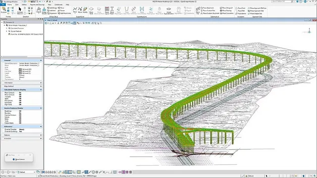
  • OpenBridge Designer: Use specialized tools for designing complex bridge structures with real-time collaboration capabilities. OpenBridge Designer enables engineers to create detailed 3D models of bridge structures, perform structural analysis, and ensure compliance with design codes.

Construction Simulation

  • SYNCHRO 4D: Integrate 3D models with project schedules to visualize construction processes over time. By combining Building Information Modeling (BIM) with scheduling data, Synchro 4D enables project teams to simulate construction activities, identify potential clashes, and optimize workflows.


Digital Twin Implementation for NLEX-SLEX Connector Road Project

The NLEX-SLEX Connector Project is a vital DPWH infrastructure initiative in the Philippines, aimed at improving traffic flow and connectivity between major thoroughfares. Developing roads in a dense urban center presented challenges, including right-of-way issues and limited space for construction equipment. The implementation of Bentley Systems’ mixed reality solutions in this project provides insights into the transformative power of technology in infrastructure development.

The project boosted productivity by 15% and equipment logistics by 40% through mixed reality and Digital Twin technology. The new road reduces travel time by one hour, saving approximately 315 million kilograms of carbon emissions annually, highlighting the Philippines' commitment to sustainable infrastructure.

This project proudly stands as the winner of the prestigious Year in Infrastructure 2024 - Going Digital Awards, held this October in Vancouver, Canada. This recognition not only highlights the innovative use of cutting-edge technologies but also underscores the Philippines' commitment to advancing its infrastructure capabilities. The NLEX-SLEX Connector Project exemplifies the nation’s drive towards modernization and sustainability in transportation.

Winning this international accolade reflects the collaborative efforts of the Department of Public Works and Highways (DPWH), Infrasys, and Bentley Systems, showcasing their dedication to excellence and innovation. This achievement serves as a beacon of pride for the Philippines, demonstrating how advanced digital solutions can transform infrastructure development, improve connectivity, and enhance the quality of life for Filipinos. It positions the country as one of the leaders in adopting modern engineering practices, inspiring further investments and advancements in the infrastructure sector.

Role of Infrasys

Infrasys plays a crucial role in the successful delivery of the NLEX-SLEX project by ensuring that Bentley's software is effectively implemented. Infrasys’ contributions include:

  • Software Provisioning: Supplying the necessary Bentley software tools for the project, ensuring the DPWH has access to the latest technology.
  • Training and Support: Conducting comprehensive training sessions for DPWH engineers to equip them with the skills needed to utilize Bentley’s software effectively.
  • BIM Modeling Guidance: Assisting DPWH in modeling Building Information Modeling (BIM) to align with project specifications and requirements, enhancing collaboration and efficiency.

Application of Mixed Reality Solutions

  • Design Visualization:
    • Utilize mixed reality headsets to visualize the project in a real-world context.
    • Allow engineers and stakeholders to walk through the virtual model of the road connector, providing an intuitive understanding of design elements.
  • Construction Monitoring:
    • Implement augmented reality (AR) tools to overlay construction plans onto the physical site, guiding workers and ensuring accuracy.
    • Use MR to track construction progress against the project timeline, identifying delays or deviations in real time.
  • Maintenance Planning:
    • Create a digital asset management system that leverages the Digital Twin for ongoing maintenance and operational efficiency post-construction.
    • Utilize simulations to assess the impact of various maintenance strategies over the lifespan of the infrastructure.

Challenges and Considerations

  • Technological Integration:
    • Ensure compatibility between existing systems and Bentley's software to maximize efficiency.
    • Invest in training and upskilling for personnel to effectively utilize mixed reality tools.
  • Data Management:
    • Implement robust data management practices to handle the vast amounts of data generated during reality modeling and Digital Twin integration.
    • Address data privacy and security concerns, particularly when dealing with real-time data from sensors.
  • Stakeholder Buy-In:
    • Facilitate stakeholder education on the benefits of mixed reality and Digital Twin technologies to ensure commitment and collaboration.
    • Present case studies and successful applications to demonstrate value.

Conclusion

Bentley Systems' mixed reality solutions represent a significant advancement in infrastructure project delivery. The NLEX-SLEX Road Connector Project serves as a powerful example of how these technologies can enhance planning, design, and construction processes. The involvement of Infrasys, through its provision of Bentley software, training, and BIM modeling guidance, underscores the collaborative effort essential for driving successful project outcomes.

By leveraging reality modeling, construction simulation, and Digital Twin implementations, civil engineering professionals can significantly improve efficiency and reduce costs while fostering better stakeholder engagement. As the industry evolves, embracing mixed reality will be crucial for achieving sustainable and resilient infrastructure solutions. This forward-thinking approach not only supports the immediate goals of infrastructure development but also positions the Philippines as a leader in innovative engineering practices.

Incorporating mixed reality into the lifecycle of infrastructure projects not only leads to better outcomes but also paves the way for future innovations in civil engineering. This transformative approach is the future of Philippine infrastructure, enabling a more integrated workflow and enhancing the quality and durability of projects. By prioritizing these advanced technologies, the country can address its infrastructure challenges while promoting sustainability and economic growth.

January 06, 2025

Recognizing the contribution of taxpayers to local economic growth, the Local Government Unit of Claver named Taganito Mining Corporation (TMC) as the Overall Top Taxpayer for 2023 during its Garbo nan Claver Awards & Stakeholders’ Night on September 7, 2024.

TMC also received the Top Taxpayer Award for the Mining Category, ranked 7th for the Mining Contractors Category, and was awarded the 2024 Sponsorship Award.

Spearheaded by the Office of the Municipal Treasurer - Business Permit and Licensing Division, the event recognized businesses that have consistently fulfilled their tax obligations, playing a vital role in the municipality's growth and development.

Mayor Georgia Gokiangkee of the Municipality of Claver expressed her gratitude to the outstanding taxpayers and barangay treasurers in the municipality for their diligence in paying taxes, which benefits the municipality through projects and programs for the people of Claver.

“Tax is the lifeblood of the government. Kon wayay buwis, waya sab kitay mahimo. Ugsa husto ra gajud na ato pasidunggan an ato mga taxpayers (If there is no tax, there is nothing we can do. So it is just right that we recognize our taxpayers),” remarked Gokiangkee.

This year, Claver emerged as the Overall Most Competitive Municipality in Caraga based on the Department of Trade and Industry assessments and the Regional Competitiveness Committee for Cities and Municipalities Competitive Index in 2023.

Claver also ranked 3rd for Overall Most Competitive LGU nationwide in the 1st to 2nd class municipality category.

TMC is a subsidiary of Nickel Asia Corporation, a natural resources development company with operations in Barangay Taganito, Claver, Surigao del Norte.